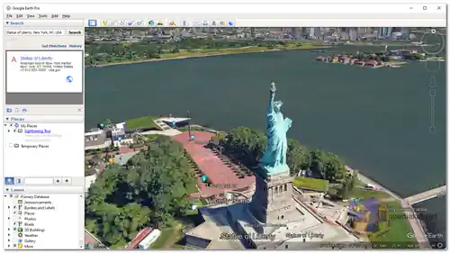
Google Earth Pro is a free desktop application that allows you to explore the world in 3D. It includes a variety of features that make it a powerful tool for education, research, and entertainment. It is a professional-grade geospatial mapping and visualization software that offers a comprehensive view of our planet's surface using satellite imagery, maps, 3D buildings, and terrain data. It is designed to cater to the needs of professionals, researchers, educators, and enthusiasts who require advanced tools for geographic analysis, mapping, and exploration...
Google Earth Pro includes a variety of features that make it a powerful tool for learning, research, and entertainment. Some of these features include:
High-Resolution Imagery:
Google Earth Pro provides access to high-resolution satellite imagery, allowing users to zoom in and explore specific areas with exceptional detail.
Measurement Tools:
The software includes advanced measurement tools that enable users to calculate distances, areas, and paths directly on the map, making it valuable for tasks such as land surveying, urban planning, and environmental assessment.
GIS Data Import:
Google Earth Pro supports the import of GIS data in various formats, allowing users to overlay custom data layers onto the map for analysis and visualization.
Historical Imagery:
Users can access historical imagery to observe how specific locations have changed over time, making it useful for tracking developments, environmental changes, and more.
Animations and Time-Lapse:
The animation feature lets users create interactive tours and time-lapse videos to visualize changes and movements on the Earth's surface.
Additional Data Layers:
Google Earth Pro offers additional data layers that provide information about demographics, traffic patterns, geological features, and more.
Custom Annotations:
Users can add custom placemarks, lines, and shapes to the map, which is useful for highlighting specific points of interest or marking locations for further exploration.
Print and Image Export:
Google Earth Pro allows users to create high-resolution images and printouts of maps for presentations, reports, and documentation.
Integration with Google Sheets:
Users can import geographic data from Google Sheets, which can then be visualized and analyzed within Google Earth Pro.
Pros of Using Google Earth Pro:
Cost-Free Professional Tools:
The fact that Google Earth Pro is now available for free makes it an attractive option for professionals, researchers, and educators who require advanced mapping and geospatial tools.
Broad Geographic Coverage:
Google Earth Pro covers the entire globe, allowing users to explore and analyze locations across the world.
Visualizing Data:
The ability to overlay custom data layers, create animations, and generate visualizations enhances the understanding of complex geographic data.
Historical Analysis:
The historical imagery and time-lapse features facilitate the analysis of changes to landscapes and urban development over time.
User-Friendly Interface:
Despite its advanced features, Google Earth Pro maintains a user-friendly interface that accommodates both novices and experienced users.
Educational Use:
Google Earth Pro is an invaluable tool for educators and students, offering opportunities for interactive lessons, research, and geographic exploration.
Community Contributions:
Google Earth Pro supports the sharing of user-generated content and custom maps, contributing to a collaborative environment.
Cross-Platform Availability:
Google Earth Pro is available for Windows, macOS, and Linux systems, ensuring widespread access.
Overall, Google Earth Pro is a powerful and versatile tool that can be used for a variety of purposes. It is free to download and use, and it is regularly updated with new features and imagery. If you are looking for a powerful desktop mapping application, Google Earth Pro is a great option.
Google Earth Pro - Changelog.
Here's a basic guide on how to use Google Earth:
Using Google Earth is relatively straightforward, and it offers a variety of features for exploring maps, satellite imagery, and 3D views of the Earth's surface.
1. Access Google Earth:
- Download and install the Google Earth application on your computer.
2. Explore the Globe:
- When you open Google Earth, you'll see a 3D globe. You can explore by clicking and dragging the globe with your mouse or swiping on a touchscreen device.
3. Navigation Tools:
- Google Earth provides various navigation tools:
- Zoom In/Out: Use the scroll wheel on your mouse or pinch on a touchscreen. You can also use the zoom buttons on the screen.
- Rotate: Click and drag with your mouse to change the viewing angle.
- Tilt: Use the tilt controls or two-finger swipe on a touchscreen to change the perspective.
4. Search for Locations:
- To search for a specific location, type the place name, address, or coordinates into the search bar at the top-left corner. Google Earth will move to that location.
5. Layers and Options:
- On the left sidebar, you'll find various layers and options:
- Places: Save and organize locations you want to revisit.
- Voyager: Explore guided tours, educational content, and interactive stories.
- Layers: Toggle various overlays such as 3D buildings, roads, and more.
- Measurement: Measure distances and areas on the map.
- Your Places: Save and organize your own placemarks and maps.
6. Street View:
- To access Street View, drag and drop the orange Pegman icon located in the bottom-right corner onto the map. You can then navigate through street-level images.
7. Historical Imagery:
- Click the "Clock" icon in the toolbar to access historical imagery. This allows you to view past satellite images and see changes over time.
8. Sharing and Saving:
- You can share specific views or save them as bookmarks. Click on the "Share" button to get a link or embed code.
9. Settings:
- Customize your Google Earth experience by clicking the gear icon in the bottom-right corner. You can adjust settings like units, language, and notifications.
10. Mobile Devices:
- If you're using Google Earth on a mobile device, the controls may vary slightly but should be intuitive for touch navigation.
Google Earth offers many more features and tools for specific purposes, such as exploring ocean depths, measuring elevation, and more. Explore the platform to discover its full potential and features relevant to your interests or needs.
Download Google Earth Pro:
For windows 32 bit:
Size: 59.54 MB - Download
For windows 64 bit:
Size: 67.61 MB - Download